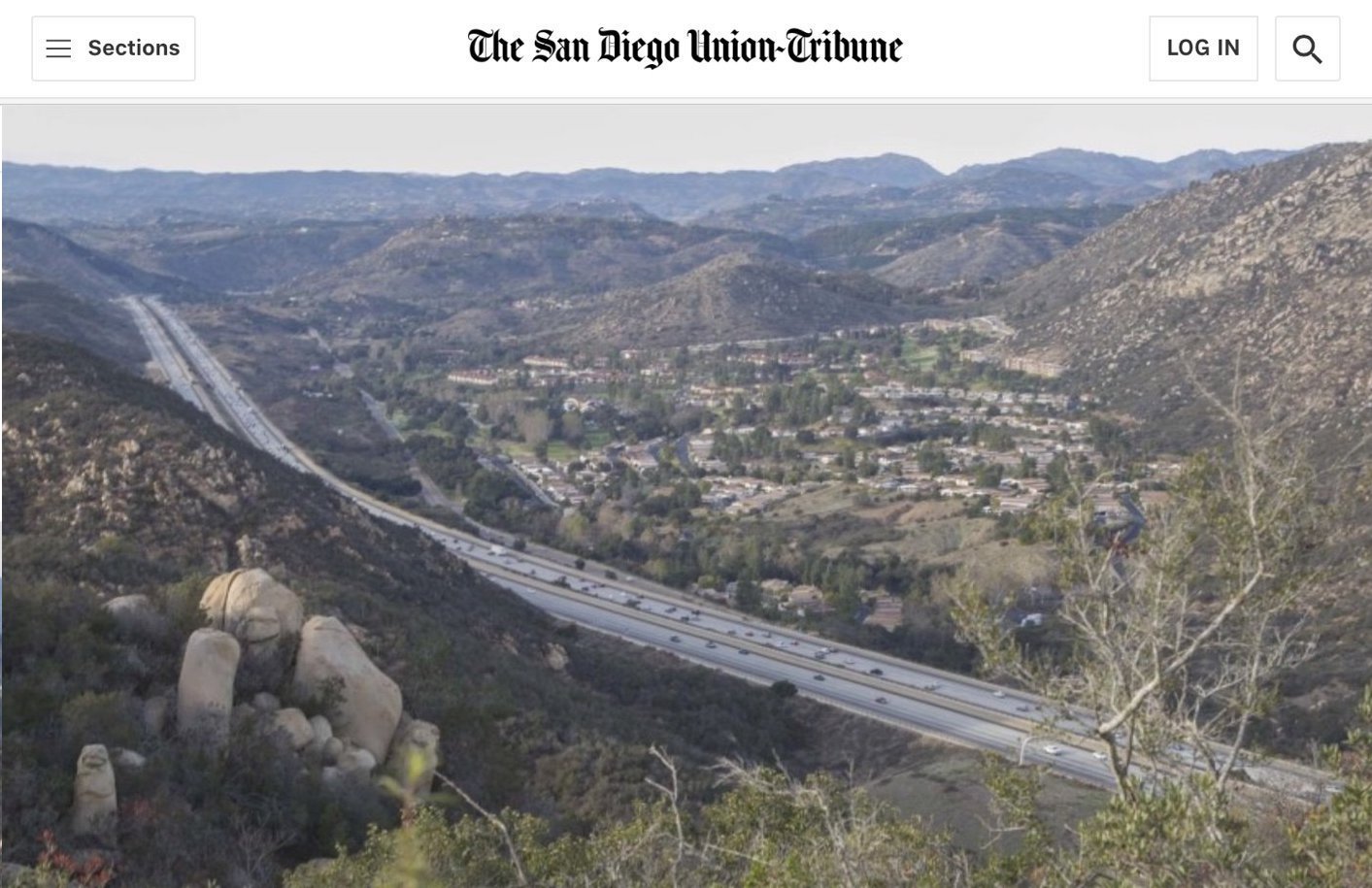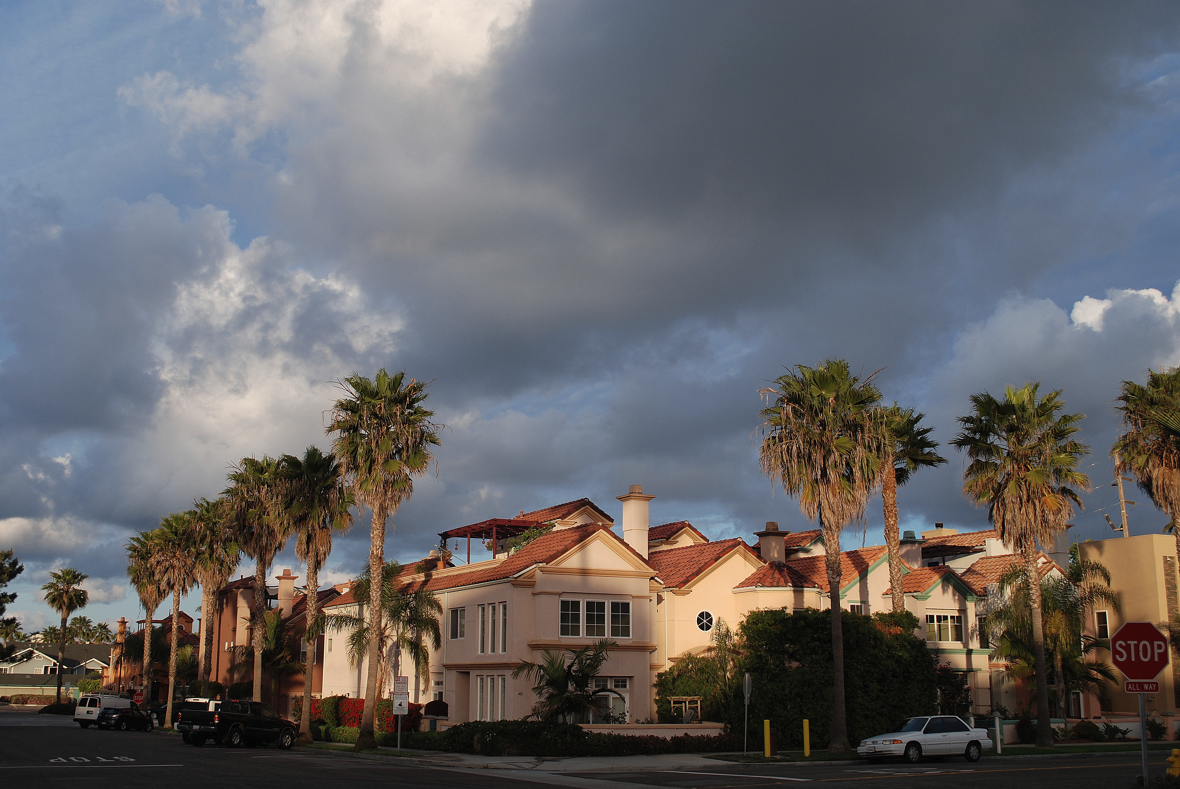
Oceanside, corner of Tremont & Civic Center (transit-rich neighborhood), Photo Courtesy of Joe Wolf
SB50 has been in the news quite a bit lately. This bill, put forth by Senator Weiner of San Francisco, effectively removes restrictions to development in targeted areas across the state, regardless of the underlying zoning or local regulations. The bill would remove height limits and parking requirements among other restrictions in areas that are considered “transit-rich” or “jobs-rich.” As with the bill’s failed predecessor (SB827) much has been made of the transit-rich areas targeted and how it would impact neighborhoods near transit. These areas are clearly defined and the objective aligns, generally, with the accepted benefit of increasing housing density near transit. However, the media does not seem to be doing as much analysis on the “jobs-rich” areas that was added to the resuscitated bill. In this post, we will attempt to spell out what exactly the “jobs-rich” areas entail when applied to San Diego County. We will not address whether or not SB50 will accomplish the objective of making housing more affordable in the near or long term. That will be for another post.
First, transit-rich areas
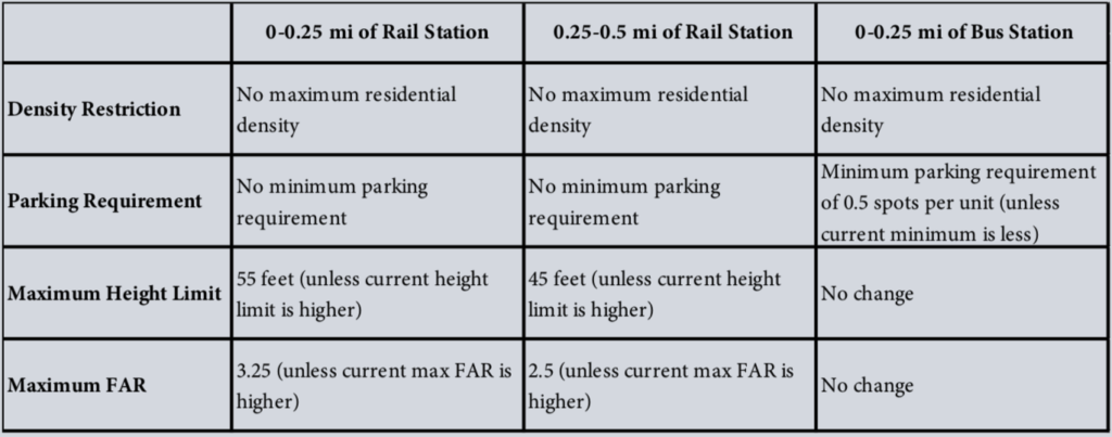
Before diving into the “jobs rich” areas, let’s quickly look at the “transit rich” areas specified by SB50. These are clearly defined areas that are within a half mile of a rail station, or within a quarter mile of a high quality bus station. A high quality bus stop is defined as follows:
- average headways of 15 minutes or less during morning (6 to 10am) and evening (3 to 7pm) peak times;
- average headways of 20 minutes or less during weekdays (6am to 10pm); and
- average headways of 30 minutes or less on weekends (8am to 10pm).
Here’s a summary by Terner Institute for Housing at UC Berkeley showing how proximity to transit defines how zoning would be amended by SB50:
However, jobs-rich areas are not clearly defined in the bill
Will likely encompass a large portion of cities in San Diego County and some parts of the unincorporated County.
The bill itself makes numerous references to “job-rich areas” but doesn’t define it quite as clearly so researchers have had to dig into the definition and find a reasonable proxy for what it refers to. Here’s what the bill says about jobs-rich areas:
(e) “Jobs-rich area” means an area identified by the Department of Housing and Community Development in consultation with the Office of Planning and Research that is both high opportunity and jobs rich, based on whether, in a regional analysis, the tract meets the following:
_____(A) The tract is higher opportunity and its characteristics are associated with positive educational and economic outcomes for households of all income levels residing in the tract.
_____(B) The tract meets either of the following criteria:
_____________(i) New housing sited in the tract would enable residents to live in or near a jobs-rich area, as measured by employment density and job totals.
_____________(ii) New housing sited in the tract would enable shorter commute distances for residents, compared to existing commute levels.
(f) “Job-rich housing project” means a residential development within an area identified as a jobs-rich area by the Department of Housing and Community Development and in consultation with the Office of Planning and Research, based on indicators such as proximity to jobs, high area median income relative to the relevant region, and high-quality public schools, as an area of high opportunity close to jobs.
So let’s parse what that actually means. The bill is leaving it to the Department of Housing and Community Development (HCD) to precisely define what “job-rich” means at a later date. Generally, as referenced in the bill, it will entail areas that have high median incomes (relative to the region), high-quality public schools and are relatively close to jobs. There is no requirement regarding proximity to transit. The reason this was added to the bill from the previous iteration (SB827) was that groups complained that focusing only on transit-rich areas would shoulder the burden of up zoning on poorer neighborhoods. By including jobs-rich areas, the argument goes, wealthier neighborhoods would have to accommodate their share of density upzoning as well.
How will they define job-rich areas?
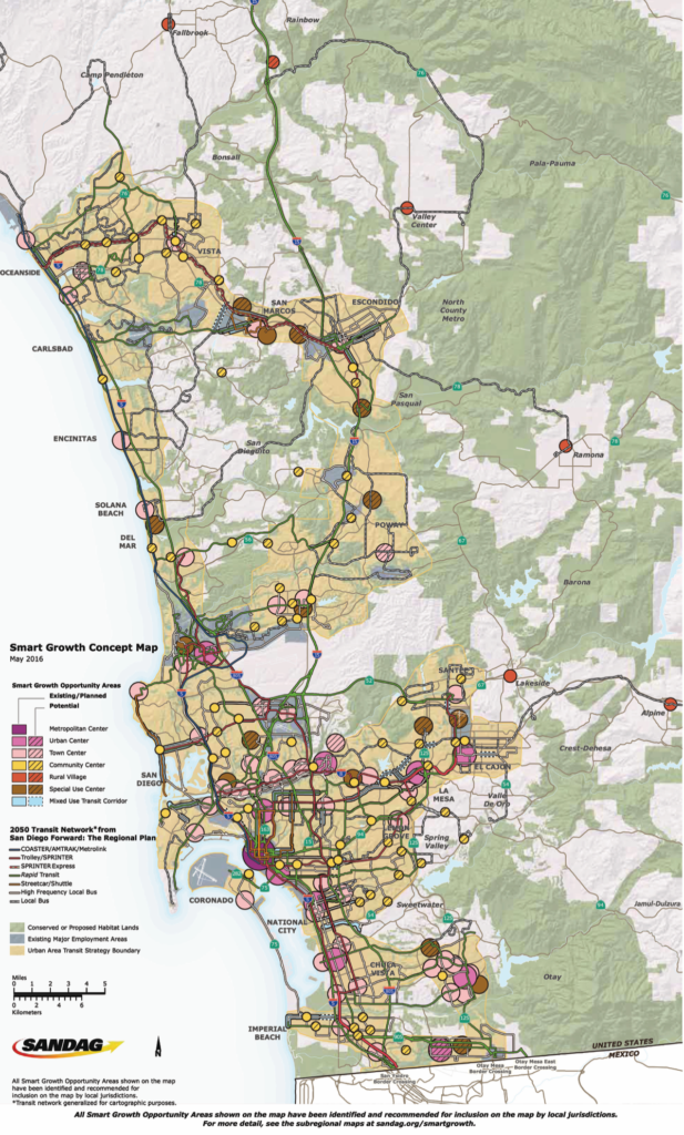
It appears that the definition for job-rich areas will be based on “opportunity maps” that were developed by HCD for its “California Fair Housing Task Force.” The goal of the task force was to ensure that Low Income Housing Tax Credit projects (LIHTC, a program that provides funding for non-profit, affordable housing) be sited not just in areas with high poverty, but also in high-opportunity areas, defined by higher property values, better public schools and higher incomes. The idea is that low and and very low income people are disadvantaged by being segregated in areas with poor opportunities so efforts are being made to site affordable housing projects in higher opportunity areas. Now, just because an area is “high opportunity” doesn’t mean it will be conducive to LIHTC affordable housing projects. Many are single-family zoned neighborhoods that don’t allow multi-family buildings or have certain density limitations. SB50 tries to address that by removing density limitations and parking requirements in those areas, but does it for all projects not just affordable projects. The end result will likely be market rate projects. The below map shows areas of opportunity in San Diego County. The orange to dark orange sections are areas that will likely be targeted by SB50, regardless of whether they are served by transit.
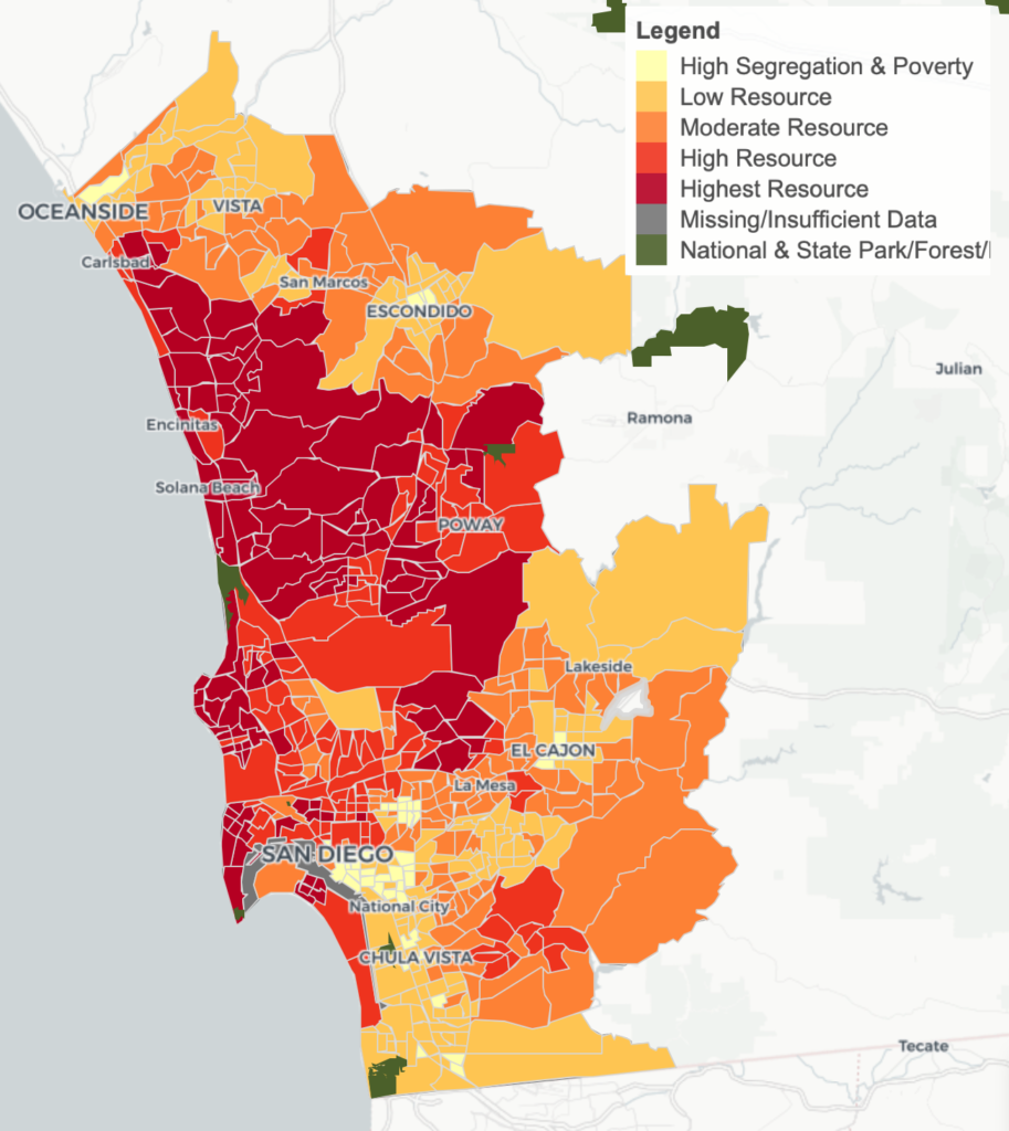
So, SB50 will likely use the same methodology that was intended to site affordable housing projects equitably and applies it to ALL development, whether market-rate or affordable. The end result is that all of the orange to dark orange areas could be subject to an up zone that would eliminate density limits, parking requirements and, depending on locations could raise height limitations. What was originally intended to provide equity and undo decades of segregation in public and affordable housing is now being used to promote mostly market rate housing which may or may not have a small percentage of affordable units (onsite units are not required by SB50).
How would this play out in San Diego neighborhoods?
Without a detailed neighborhood by neighborhood analysis, we are left with some speculation and analysis courtesy of our friends at the Terner Institute for Housing at UC Berkeley. In their analysis of transit-rich areas, they determined there are several limitations that will dictate how SB50 will impact different communities. These limitations will also impact the “jobs rich” areas as well. They are as follows:
- Residential zoning: SB50 is limited to areas that are currently zoned for residential use. Commercially or industrially zoned areas are exempted from SB50. Presumably, agricultural and open space are excluded as well. Areas where there is mixed use of commercial, industrial and residential offer fewer upzoning opportunities than neighborhoods that are exclusively residential. So, residential-only neighborhoods would see more impacts than mixed or commercial neighborhoods.
- Size of the parcels: According to form-based codes, to build a five story building, you need a minimum lot size of about 7,500 to 18,000 square feet. 5,000 square feet could accommodate smaller buildings of up to 12 units. Much smaller than that and the density potential is limited. So, SB50 will have a larger affect on larger lot neighborhoods than smaller lot neighborhoods as there is opportunity to build larger buildings and increase profit opportunity.
- Renter occupied buildings: SB50 includes a provision that prohibits demolition of buildings occupied by renters or homes previously occupied by renters in the past 7 years. How they will validate this is underdetermined at this point since most jurisdictions don’t track rental properties. Neighborhoods that have more owner-occupied homes would be impacted more by SB50 than those that have a higher number of renters.
- Financial Feasibility: According to Terner’s analysis, financial feasibility and profit potential drive investment decisions. A desirable area with higher real estate values and land costs (and thus higher rents) will cost more to build, but the return on investment is higher. In Terner’s example, identical projects proposed in Menlo Park (high income area) and Fruitvale (lower income area) would yield profits margins of 40.75% and 11.56% respectively. This tells us that high income neighborhoods will likely be targeted more so than lower income neighborhoods.
If we were to apply the above limitations to areas in San Diego, it would favor higher income neighborhoods like Carmel Valley, North Park, Carlsbad, parts of San Marcos, Oceanside and most areas west of the 15 freeway. In essence all these neighborhoods would likely see their zoning change to allow more density and a removal of parking restrictions. It, in effect, institutes a blanket up zone of most areas in the cities of San Diego similar to what was recently implemented in Minneapolis, though with less restrictions. Minneapolis specified the types of housing that could be up zoned (duplex, triplex and quadplexes). SB50 simply does away with density restrictions altogether and removes height limitations in transit-rich areas. Ideally, the various cities and jurisdictions should be responsible for how to add the appropriate density to their areas, adjusting their zoning and general plans to meet those goals, rather than having the state dictate a one-size all approach.
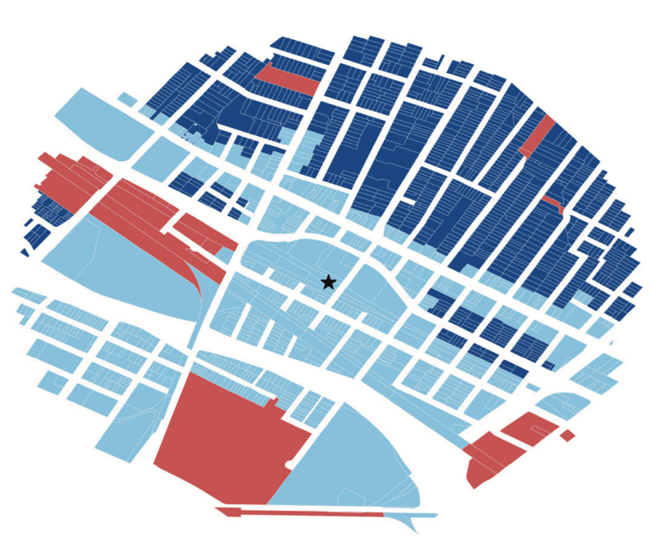
If you want to see how it might affect you, an interactive map put together by UC Berkeley’s Terner Center, below, allows you to zoom into various areas to see if they are likely to be covered under SB50. Click on the map and select the first scenario (High-Opportunity + Jobs-Rich, Long In-Commutes, and/or Jobs-Housing Mismatch). According to Liam Dillon of the LA Times, this is the same map that Senator Weiner’s office is using, though they are not publishing maps at this time.
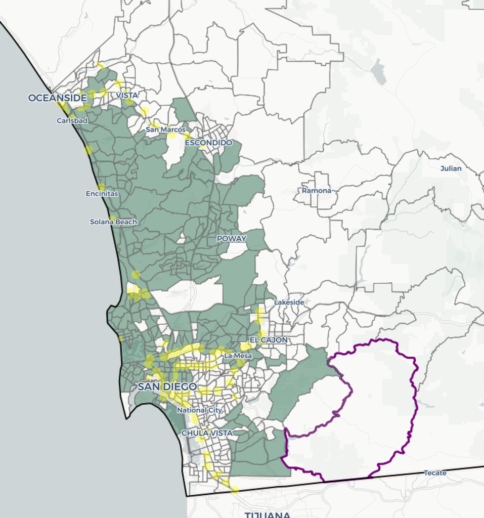
Photo courtesy of Flickr User: Joe Wolf, used with Creative Commons license